
Researchers from Ben Gurion University (BGU) have found a way to trace the location of drone operators using the drone’s flight path. The increase in drone-based threats has pushed governments all across the world to incorporate more anti-drone defense solutions. However, there have been several near-fatal civilian drone intrusions. Like the incident when a drone almost crashed into a passenger plane.
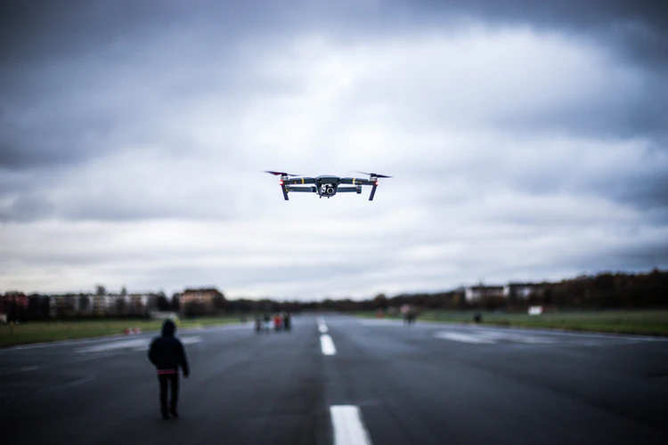
The nuisance of such malicious drones at airports, rallies, and events can prove to be dangerous. Therefore, this new method traces, rather predicts, the location of the drone operator. This system requires no additional use of sensors or hardware and continuous development can be more efficient and faster than anti-drone defenses.
Tracking malicious drone operators
Headed by Professor Gera Weiss of BGU’s Department of Computer Science and Dr. Yossi Oren from the Department of Software and Information Systems Engineering, the team published a research paper that focuses on monitoring flight paths of the malicious drones.
The researchers used an open-source, realistic drone simulation environment called the AirSims to collect the flight path of the drone. They then trained a deep neural network to predict the location of the drone operator based on the collected data. Using neural networking the algorithm was able to achieve 78% accuracy which is a substantially good start. Such a detection model would be able to work autonomously to localize the original location of the drones. In fact, detecting the location of a drone operator may prove to be more effective in curbing malicious drones than just taking down the UAV using anti-drone defenses.
How does the detection model work?
The research paper lists a set of problems with the current method of location detection. All current methods involve some form of sensor-based approach (RF, radar, EO, etc.) This approach works on a specific model of drones. Additionally, drone signals can be tracked only close to the drone. An experienced operator can even go around this by encrypting the drone communication. Thus, the available methods of tracking a drone’s origin are rendered ineffective.
“Currently, drone operators are located using RF techniques and require sensors around the flight area which can then be triangulated,” said lead researcher and computer science student Eliyahu Mashhadi. “This is challenging due to the amount of other Wi-Fi, Bluetooth, and IoT [internet of things] signals in the air that obstruct drone signals.”
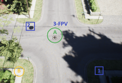
The proposed solution does not offer exact localization but an approximation of the drone’s origin. The new model works by analyzing the reaction of the drone to environmental factors along with its flight path. This reportedly gives away ample information about the location of the operator. Another added advantage is that this method can be tested from a large distance, thereby mobilizing the infiltrating drone even before it reaches the target. This model can also help identify whether a drone operator is flying in FPV or if there is more than one operator. For instance, an airport can preemptively block the operator’s line of sight using this method. This would practically disable the drone’s operation.
Privacy concerns for drone operators
This method of location tracking holds immense potential. The researchers mentioned in their paper that in future versions of this technology, extraction of critical information such as the precise identity of the drone operator might be possible. Anti-drone solutions of such complexity are not available commercially and should not pose as privacy threats to legal civilian drones. With the increasing effectiveness of such a model, regulations around privacy could be discussed and brought forward. If your drone enters into restricted airspace (learn about the different types of airspace here) or flies close to an airport, then any form of counter-drone action is inevitable.
However, you can use a flight management application such as Flykit, to stick to your flight boundaries and get daily weather updates. Flykit gives you the option to import a flight plan in KML format or export it to your flight planner. Storing your operation documents and generating ready-to-print flight reports is much easier using Flykit. The app is compatible with any drone model and device and the best part is that it’s completely free. Check it out here.


