
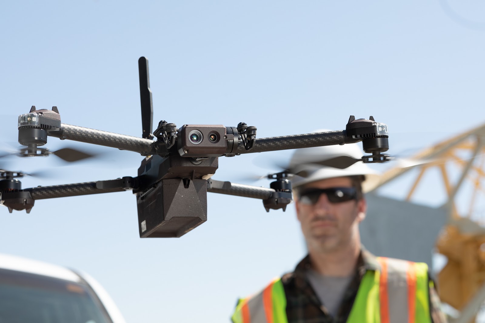
The California-based autonomous drone startup Skydio successfully raised $100 million in a Series C funding round. Soon after, on 13th July 2020, the company announced the X2 drone lineup along with brand new software solutions. The funding round saw new investors such as Levitate Capital and NTT DOCOMO Ventures, as well as existing investors a16z, IVP, and Playground. This latest funding would help Skydio move up in terms of developing its commercial drone technology and widen its market reach. The newly announced Skydio X2 is a tough competitor against the DJI Matrice series. Moreover, with an additional input of $100 million, the company’s R&D is expected to double up. Here is a quick glance at the specifications of the Skydio X2:
Skydio X2 Specifications
- Battery Life: 35 minutes
- Transmission Range: 6.2 kilometers
- Thermal Camera: FLIR- Boson 320×256 LWIR Sensors
- Color Camera: 12MP
- Six 4K Navigation Cameras
- Zoom: 100x Digital Zoom
- Electronic Image Stabilization
- Lights: IR and visible lights (strobe/solid)
- Gimbal: 180 Vertical View
More detailed specifications will follow once the Skydio X2 is commercially available. Skydio plans to launch the drone in the 4th quarter of 2020. At first glance, the X2 manages to check all the boxes including portability, autonomy, situational awareness, and image quality. At a time when the US government is pushing against DJI products, the Skydio drone lineup can be a gamechanger.
With the X2, Skydio makes big promises. The drone’s thermal LWIR sensor, the FLIR 320×256, reportedly provides 4x higher resolution than that of DJI Mavic 2 Enterprise. This is especially a great deal not only for commercial applications but also for the military. Also, the drone comes with a new enterprise-grade glove-compatible touch controller that extends X2’s range to 6.2 kilometers. Skydio will offer the drone initially in two variants:
Skydio X2D
This variant is built keeping in mind the US Army as well as other defense and security sectors. It has short range reconnaissance (SRR) capabilities. Therefore, it is ideal for reconnaissance, search and rescue, and security patrol missions. Adding its compact and portable frame, this configuration is optimum for the defense industry.
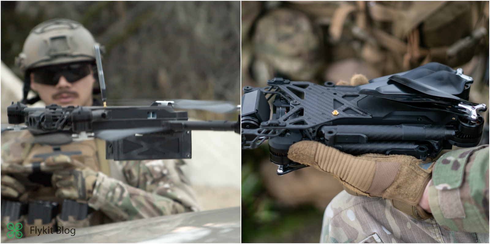
Skydio X2E
The X2E is primarily built for commercial applications like inspections of bridges, power plants, buildings, power grids and railyards. Skydio’s situational awareness makes this drone extremely versatile autonomous tasks and obstacle avoidance. Therefore, the X2E makes it safe to fly at close distance to capture more accurate data than traditional manual drones.
Skydio Autonomy Enterprise Foundation: Groundbreaking AI Technology

Alongside the announcement of the X2 lineup, the company also announced its latest AI technology called the Skydio Autonomy Enterprise Foundation. This new AI engine will revamp Skydio’s existing Autonomy Core. Thereby, making flights more autonomous, efficient, and safer. The technology brings in very powerful pilot-assist capabilities.
We have already seen Skydio’s AI engine at work in Skydio 2 (read about it here) that uses real-time 3D mapping and an impeccable obstacle avoidance system. This latest addition is set to enhance that.
What does the new system provide?
360 Super Zoom: This feature uses data from the 7 on-board cameras on the X2 and provides a 360° view. This boosts the drone’s situational awareness dramatically. This will allow pilots to see in all directions at once while enabling them to zoom up to a 100x at any given point.
Precision Mode: This is like a pro-mode for the X2. The precision mode turns on Skydio’s autonomy engine to help pilots safely maneuver in very tight spaces. Precision mode allows pilots maximum control in close proximity areas (obstacles at 0.5 meters).
Vertical View: The drone captures images at 180°, directly above it, using this feature. The vertical view aids the obstacle avoidance system and provides the drone with greater autonomy. This lets the pilot focus on the operation rather than manually avoiding overhead obstacles.
GPS Night Flight: Using X2’s on-board FLIR thermal camera/the IR Illuminators and precision GPS, a pilot can easily carry out drone operations in the dark. Having the flexibility of thermal as well as night vision makes night operations seamless.
The all new 3D and House Scan
Another striking software upgrade is the Skydio 3D scan. This is a general purpose digital scan software that scans infrastructures like buildings, power plants, bridges, etc autonomously. It builds a new real-time visual 3D reconstruction layer built on top of Skydio Autonomy Enterprise Foundation. An advantage of this feature is its independence from GPS and the internet. The AI-powered software can produce an accurate 3D scan without the use of GPS and an internet connection.

House Scan is an exclusive addition for real estate operations. The Skydio House Scan “Enables home insurance agents to automatically perform accurate inspection of residential homes safely and without the need to become expert drone pilots.”
The Autonomy Enterprise Foundation, 3D and House Scan features will not only be available in the X2 but will also be updated in the S2. With the launch closing in Q4 of 2020, even the S2 will receive firmware updates containing the latest AI additions.
“Skydio’s goal is to unlock the value of drones by creating a radically simple user experience through the power of true autonomy. With Skydio 2 (S2) we’ve proven that our autonomy software can fundamentally change the way people use drones, and that an American company can not only compete, but can lead the way in AI-powered drone technology. We are now bringing the power of autonomy to enterprises, government agencies, first responders, and defense customers.” Adam Bry, Skydio CEO, stated.
Need help managing your drone flights?
No matter the autonomy of a drone, bad weather and restricted zones can leave you grounded. By using a drone flight management application such as Flykit, you can receive daily weather updates and never miss a good flight day. Flykit also gives you the option to import a flight plan in KML format, thereby, enabling you to avoid restricted airspace. Storing your operation documents and generating ready-to-print flight reports has never been this easy. The app is compatible with any drone model and device and the best part is that it’s completely free. Learn more about it here.


